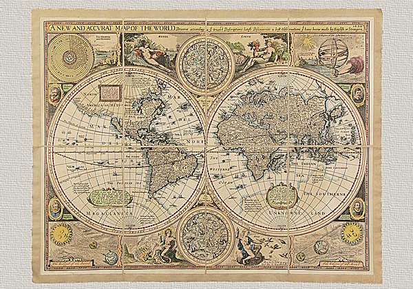


Description
The World Map by Fra’ Mauro (1460) MCCCCLX Adì XXV Avosto fo complido questo lavor.
Antique world maps can be considered some of the most reliable evidence regarding scientific and philosophical conceptions of certain eras. The world was represented as it was seen and experienced by navigators, as it was known by geographers and as it was imagined where human knowledge had yet to explore. This is especially true for geographical Medieval maps, obviously preceding the era of great explorers and discoveries, where we may find elements of imagination playing a dominant role in their representation. The mapmakers of that time were surprisingly accurate yet they included a sense of mystery regarding a world that was still not completely known to them, representing therefore their fears mixed with their hopes as to what laid still undiscovered. We observe, therefore, irrational and subjective elements that were important parts in the representation of the world. These works convey an image of the world as being on the border between objectivity and subjectivity, reality and fantasy, placing them truly amongst what we may call works of art.
The World Map by Frà Mauro is undoubtedly a shining example of such a work.
Information regarding its author remain quite mysterious. We know that he was from the region of Veneto and that he belonged to the brotherhood of the Camaldoli monks on the island of San Michele in Murano, Venezia. In 1444 he partecipated in the work commissioned to resolve the issue of the origins of the waters of Brenta. From 1448 on he dedicated his energies to mapmaking. He worked in a sort of cartographic laboratory along with other members where he not only produced the work you see here but also a cosmographic map commissioned by Alfonso V, King of Portugal.
What remains a mystery is how this man could have drawn such images without having traveled even once in his lifetime. Legends say that the imagery came to him in his dreams during cloudy nights…He died in 1459 when he was just completing the World Map which was probably finished by his assistants. There are two elements that confirm this: One is that the spaces left for the legends are empty and the other is that there is a clear writing on the back of the work stating: MCCCCLX Adì XXV Avosto fo complido questo lavor which translates into a precise date: 25 August, 1460, after the author’s death. The original map measures 2m 23 cm on its square sides and has an outlining that is slightly elliptic. The work was hand written and colored on parchment which were then glued onto a wooden base. There are more that 4000 inscriptions offering descriptions and information regarding some of the most unusual places in the world… keeping in mind that the discovery of the Americas had yet to take place.
The following three continents are depicted: Europe, Africa and Asia. Inspiration for Europe seems to derive from a nautical map whereas for Asia, which is the largest representation depicted here with a crown of islands around it, was probably inspired by Marco Polo’s “Milione”. Many studies seem to agree that the work was begun before 1450. The orientation of the map is of exceptional innovation for that time period and is also of great importance for the history of mapmaking: It was not placed to the east, as was common in Christian traditions but was to the south as was typical in Arab maps. Moreover, Jerusalem does not appear at the center but is substituted by Baghdad and the lands of Mesopotamia. All lands are surrounded by the ocean and parallel and meridian lines are absent completely. It also lacks a scale but is rich in beautiful decorative elements such as temples, views of cities adorned with flages, ships, monumental buildings and sea monsters. In the four corners of the map there are the figures and imagery regarding the Medieval concepts of the theory of homocentric spheres from the Aristotelian- Ptolemaic system. The iconography found in the left inner corner is of particular interest; it depicts the Garden of Eden and the Earth according to the Holy Scriptures. The legend found above it reads: “Perchè la sacra scriptura fa mention del fonte del paradiso et ancora de queli quatro fiumi che nasceno da quello, però ne la presente pictura se dimostra questo e perché sono molti che se meravigliano come sia possibile che questi quatro fiumi nassando da questo luogo remotissimo habi li suo fonti distantissimi l’uno da l’altro, respondo secondo sancto Augustino sopre el Genesi, che questi fiumi, hi fonti di qual no sono noti, habino luogi subterranei e passando molte region nassano in diverse parte e che uno cioè Ganges, nassa in India, Tygris in Armenia dal monte Charaback, Eufrates similiter in Armenia apresso la cità Arceron, et Gen ouer Nilo in Ethyopia in Atassia, in la provincia de Meroa.”
One can even indulge in fairy tales and legends of this period. For example, observe the islands of Capo Verde, or the mythical columns of Hercules, (which at one time were placed in the Straits of Gibraltar but was later moved to the lands discovered as more explorations took place), but it seems as though Frà Mauro doubted that they existed and he desired a confirmation by the Portuguese. The World Map by Frà Mauro is preserved in the Biblioteca Nazionale Marciana in Venice. It has appeared in numerous publications and has been the subject of various studies involving not only the history of mapmaking but also the history of Venice. It is undoubtedly a supreme synthesis of an extremely important historical and cultural moment and here we present to you a new “edition” of this work so that it may be admired and consulted in all of its beauty. It is produced on pure cotton paper which is then mounted on canvas and has been reduced in size in order to facilitate the reading and transport. The quality of its colors and the extraordinary wealth of details cannot but amaze and delight the observer.