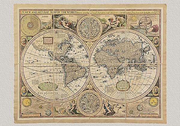


Description
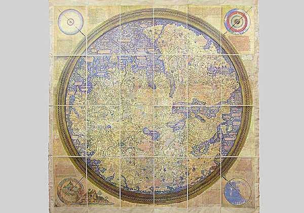
Typus Orbis Terrarum by Abramo Ortelio – 1500, original engraving hand watercolored.
“Anvers, à cette époque, meritait sans aucun doute d’ètre considèrèe comme notre principale cité sous le rapport intellectuel.” Such were the words of the Belgian astronomer Quetelet as he wrote in his Histoire des sciences mathematiques et phisiques chez le Belges, (1864). It was in fact during that period, (i.e. the latter half of the 16th century), that the city of Antwerp found itself at the peak of commercial, economical and artistic success. The Flemish city developed so rapidly that after only a few decades was destined to become the most vivacious and flourishing city in most of Europe. Here one could find the refinishing of English fabrics, glass works as well as soaps, paper, and cereal products from the Baltics, sugar from the Canary Islands, Italian alum and silks, French wines , fish from Zealand and the manufacturing and refining of textiles, (linen, lace and tapestries, Brabante and Flanders-linen)which made their stops here only then to be shipped to ports all over the four continents. Antwerp, however, was also the crossroads of trading and of colonial products on a large scale. First among those were spices. The city was a center of great commercial and financial operations thanks to the liberty granted from the political government at that time. For the first time in the history of the world there was not only a European market but a world market based on enterprising relationships among the various European regions all being linked economically to the rest of the world. Together with this positive economical period of success Antwerp was also a place where intellectual and artistic activity flourished. The city became a meeting place for major artists and intellectuals of the time and important typographic workshops were born, therefore increasing the spread of philosophical and theological treatises, as well as geographical atlases.
The enterprising initiatives of the explorers and European merchants during that time found comparison in an intense production of cartographic collections; hundreds of copies were produced, thanks to the development of copper engraving. We cannot but include the activity of Abraham Ortelio, (Antwerp 1527-1598), in the description of such an interesting period of history, where man came were produced, thanks to the development of copper engraving.
We cannot but include the activity of Abraham Ortelio, (Antwerp 1527-1598), in the description of such an interesting period of history, where man came to know the borders of his world. He was a typical intellectual of the Renaissance as well as a curious explorer, fascinated with antiquities. During the International Fair of Frankfurt on the Meno, (1554), he bought his first maps which he would later mount on canvas. He was aware of the scientific and commercial advantages tied to the production and printing of maps, therefore he published in 1564 his first map, Typus Orbis Terrarum, (copper engraved). In later years he would publish other important works, such as America, Asia (1567) and finally the atlas Theatrum Orbis Terrarum in 1570. The production of this work enjoyed a long publishing during his lifetime and continued even after his death. The historical-cartographic caliber of this work became one of the most important maps, if not the most important map of the 16th century. In fact his contemporaries named him the “Ptolemy of the 16th century”. We find it quite interesting to examine here his first work, Typus Orbis Terrarum (1564). Its structure follows that of Bordone’s oval projection and depicts the terestrial globe as it was known at that period in history and do show some characteristics that are almost
true. The exquisite aesthetic layout of the map is a characteristic of Ortelio; a rich and ornate shaping.
We present this Typus Orbis Terrarum as it was originally created and printed, just as the author had done: It is engraved on pure cotton paper using a manual press and finely engraved copper plates and is then mounted on canvas. In order to give the work an antique look we have then performed an aging process using only natural substances. The final step in our production is the watercoloring done by experts in the field and upon completion one can admire this work almost 500 years after its original creation. The result is here before your eyes.
The map is gently wrapped in a fabric envelope and enclosed in an elegant box for safe keeping. This map is something that one may find hidden in an attic one day—a veritable treasure, one of the most important maps done by the “Ptolemy of the 16th century”.