


Description
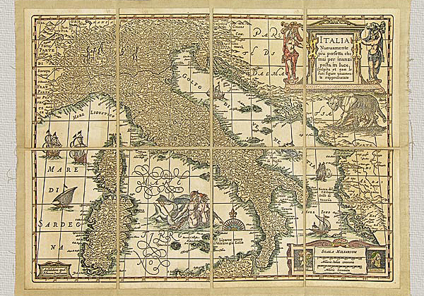
Italy – L’Italie Divisée Suivant l’Estendue de Toutes ses Souverainetés by Sanson (1672), original engraving hand watercolored.
The invention of the printing press gave the humanists the possibility to spread their genius and knowledge produced in their fields of study. Thus the progress of knowledge began its wondrous ascent that was both a revolution as well as a revelation. It was a revelation because it allowed all forms of discipline to expand and reach people and places that until then had been more or less far from cultural contacts and exchanges. It was a revolution because the field that had been reserved to copyists and illuminators had been radically changed with the advent of the most renowned schools of typographic impression. Some fine Italian schools were the Giunti in Florence, the Gioliti de Ferrari and the Aldo Manuzio in Venice.
Map engraving experienced particular success during the 17th and 18th centuries when people and their countries could learn about one another more. It was thanks to contributions made by brave travelers of that period, as well as fervent missionaries and specialized scholars who studied the terrain and its systems who furnished more and more information about our world. But it was only in the 18th century that the shape of the Earth was defined. After having perfected measuring instruments and obtained an international organization of specialized studies and geodetic measurements, the creation of large national maps and cartographic representations embraced the world known to man.
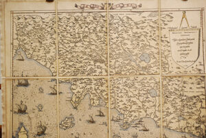
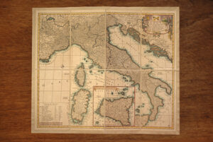
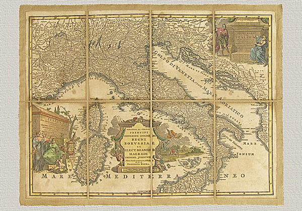
We have here a beautiful representation of Italy that dates back to 1600, although it clearly lacks in the precision of measurements and consequently suffers in design.
The geographer S. Sanson is the author of this work that was produced in 1672 in the Paris workshops of the famous mapmaker H. Jaillot.
It was copper engraved and mounted in separate pieces on canvas. The representation extends itself to the west beyond the borders of France and continues to the north beyond the “hongrie” and to the east of Dalmatia.
The orography (depiction of the terrain) is represented in perspective with the usual system using small hills and mountains. The toponymy is in Italian and French. At the top of the map there is a second title whose meaning is more or less like that of the one cited at the bottom of this summary. On the bottom left there is a chart illustrating various scales (seven) and a dedication to Delfino of Francia. The technique used to reproduce this map is the same one that Jaillot himself employed: A manual press, finely engraved plates and pure cotton paper. The paper is then mounted on cotton canvas reflecting the frequently used working procedure employed in the past because it was (and is) necessary to obtain the best preservation possible as well as to ensure an easy shipping of the maps. Only the aging process, obviously, is an operation that our predecessors would not have needed to use. This is done with a series of all natural substances. Finally, the watercoloring gives the work a polychrome vision of indubitable scenic effect. All this work is done in order to produce an object that can bring back the piece’s beauty and historical and cultural value of the original, employing the same materials and technique used so long ago.