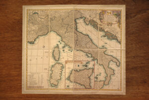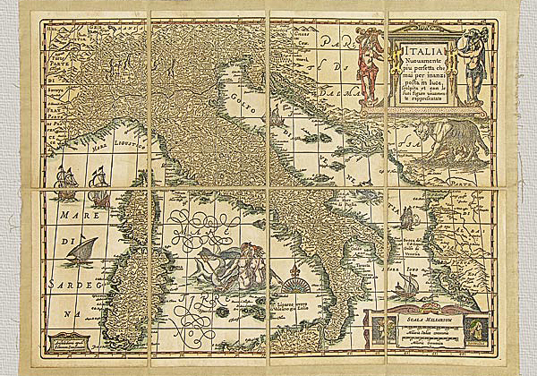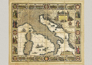


Description
Italy by Cantelli da Vignola, original engraving hand watercolored.
“Italia cum Stationibus fuis et viis Publicis Delineata” or “Niewe Kaart van Italien met de gemene wegen en Postwegen”.
In the 18th century the shape of the Earth became defined with remarkable accuracy. After having perfected measuring instruments and obtained an international organization of specialized studies and geodetic measurements, the creation of large national maps and cartographic representations embraced the world known to man. In the topographic and cartographic fields the 18th century was characterized by the research for more and more precise methods of representation especially those regarding the shapes of terrestrial relief. The system of direct relief was introduced by means of the “tavoletta pretoriana”, created by Pretorius, an instrument of practical and assured efficiency. Many mapmakers during this historical period prepared the production of maps for their respective countries and there was feverish activity in various publishing houses that wished to print this cartographic material. A particularly interesting example that we present here is this Italia del Cantelli Da Vignola, published by Francesco Halma in Amsterdam and dedicated to Prince Federico Guglielmo, Duke of Modena. There are two titles in German and in Italian. This cartographic representation has a normal position. The lines of longitude originate from the islands of Cape Green and the orography is in prospective. The streets are represented with two parallel lines. The engraved plates are the work of G. Droogenham, abuilding surveyor.
The technique used in producing this map is the same one used by the antique mapmakers. This includes a manual press, finely engraved plates and pure cotton paper. The paper is then mounted on cotton canvas reflecting the frequently used working procedure employed in the past because it was (and is) necessary to obtain the best preservation possibleas well as to ensure an easy shipping of the maps. Only the aging process is an operation that our predecessors would not have needed to use. This is done with only natural substances. Finally, the watercoloring gives the work a polychrome vision of indubitable scenic effect. All this work is done in order to produce an object that can bring back the piece’s beauty and historical and cultural value of the original, employing the same materials and technique used so long ago.